CONFERENCE
"StatBox" Simulation System for Spatial Analyze
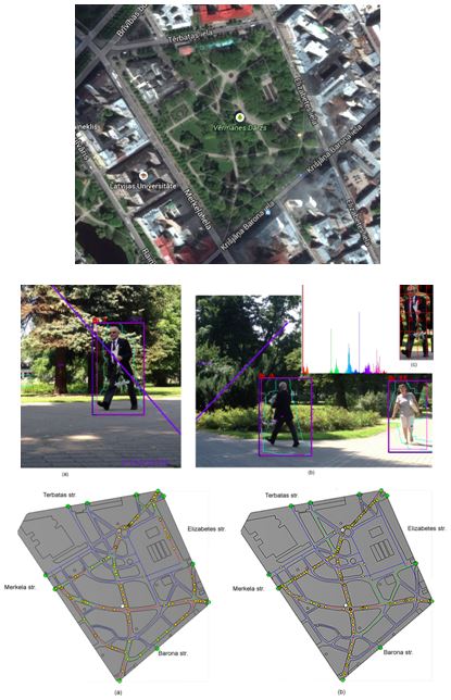
In 2011 project “StatBox Simulation System for Spatial Analyze” was submitted in European Satellite Navigation Competition. It is the tool for collection of input data and preparing of real world adequate simulation model based on the collected data. The obtained statistical information serves as a basis for creation of adequate geosimulation model, which can be further used for geosimulation experiments and scenario forecasting, for example, applicable for risk assessment and management, development planning, pedestrian and transport flows analyse and planning etc.