 CONFERENCE
Development of the first experimental software in Latvia
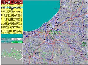
From 1992 to 1993 was developed low-end GIS software package DigitKarte with the first digital map of Latvia. The latest paper map at the scale of 1:200,000 was used as the initial data source, with the proprietary DigitKarte software serving as the principal software tool. Later the digital map was updated from other sources and substantially expanded, turning it into a true geographical database.
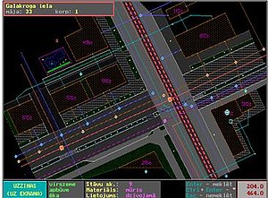
In 1994 the experimental TrubuDors software for a public utility geographical information system was developed.